Looping with Karen & Rob

Wednesday, March 20, 2024

Welcome to Kentucky

This Riverboat Still Cruises The Mississippi and Ohio Rivers

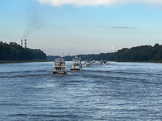
We left Hoppie's on a chilly 42 degree morning to continue on down the Mississippi. Our next marina was over 200 miles and 4 days away but we were armed with the knowledge we learned at the Hoppie's briefing and we had an idea of where we wanted to anchor along the way. We were still with our buddies on Sea Clef and Beyond and were joined by two other loopers as we headed out. Our first day's goal was anchoring near the Kaskaskia Lock and Dam where the Kaskaskia River flows into the Mighty Miss.. Many Loopers have been able to tie up over night on the lock wall but the lock was undergoing repairs so tying up was not an option. The lockmaster had us transit through the lock and advised us to anchor for the night above the dam. It turned out to be a very pretty and quiet anchorage and we had a peaceful night.

Entering Kaskaskia Lock - Under Repair
Woke up to another chilly morning!

We awoke the next morning to thick fog and a chillier 39 degrees. Time to fire up the heater! In what would become a fairly common practice for us as we headed into fall, we fired up the generator in the morning to run the heater and warm us up a bit as we had our coffee and tea. Once the fog lifted we transited back down the Kaskaskia Lock and re-entered the Mississippi and continued south to Cape Girardeau, MO. Although this looks like a cute town with an historic old fort, there are no places along the waterfront for recreational boaters to tie up. Instead, we would anchor in Little Diversion Channel. This is a popular anchorage for Loopers - not because its a great spot but because there are no other decent options in the area. The current in this part of the river was quite rapid and strong and entering the channel required us to float past the entrance, make a rather harrowing u-turn and fight the current as we left the river and entered into the channel. In one way, it lived up to its name- it was little. On the other hand, it seemed to resemble more of a creek than a channel. This would be our tightest anchorage yet as 9 of us jockeyed for position in this narrow creek. To maintain our positions in the deeper center of the channel, we all had to deploy both bow and stern anchors so we would not swing. The concept is easy. Drop the bow hook first and back down to set it. Then let out additional line to continue backing up until you reach a spot to drop the stern hook. Then slowly pull back in on the bow anchor chain and let out the stern line until both anchors are set with the boat in between them. In the tight confines of this channel it was not quite as easy as the concept. It took us two tries to get the stern anchor to set and the mud that came up with the anchor as we brought it in made for a sticky and dirty job. But - we got them both set and settled in for the night with a nice salmon dinner with corn on the cob and salad. That's one of the nice things about cruising on boats....you can settle down in the middle of nowhere with all the comforts of home!


6X5 =30 barges on one tow - biggest one we have seen so far!


Cape Girardeou Bridge


Little Diversion Channel

Leaving the anchorage the next morning morning required the reverse maneuver with the anchors. Karen let out the bow anchor while I manually pulled in on the stern. The anchor had set well overnight and hauling that stern anchor in by hand was not fun... but a little work out is never a bad thing. Our flotilla planned to head to an anchorage just off the side of the Mississippi just before it intersects with the Ohio River. Unfortunately, when we got there, there was a dredge working in the area and they would not allow us to anchor there. We had to scramble to find another anchorage and make a new route on the fly. Although our plans for the next day did call for us to leave the Mississippi and head up the Ohio River to Paducah, we were not planning on anchoring on the Ohio. We had seen that other Loopers had been allowed to anchor below the Olmstead Lock so we made that our destination. As we rounded the corner onto the Ohio, we transitioned from travelling down river on the Miss to up river, against the current on the Ohio. It also quickly became apparent this would be, perhaps, the most commercial and busiest stretch of river we would see. It was far busier than the area around St. Louis. There were multiple large tows running up and down the main channel, dredges working the center of the river, and smaller tugs and barges running up and down the side of the river. A few days before, a Looper couple hit what they believe to be an unmarked, submerged barge and did significant damage to their hull and props. Needless to say, we had our eyes, ears, and spider senses on high alert as we made out way up to the river. As expected, when we approached the Olmstead Lock, the lockmaster advised us to anchor for the night below the dam. The area was large and wide open but had significant current. After setting our anchor, we monitored our position very closely for a few hours before we were comfortable that we would be ok over night.


The Ohio River had the most commercial traffic we have seen.

Our flotilla made it through the night without anybody dragging anchor. We warmed ourselves up and headed out. The Olmstead lock was another huge lock but had only a 10  foot rise. Our travels this day northeast on the Ohio River was only 31 miles but was filled with passing tows and barges. A little after noon we were tied up at the city docks of Paducah, Kentucky.


Olmstead Lock and Dam

Paducah City Docks

We had no great expectations for Paducah other than it being the home of the National Quilting Museum. However, we found it to be a very charming river front city. The downtown historic district is listed on the National Register of Historic Places. The river front walkway was filled with large murals depicting the history of the town and the river. The area was first settled in 1821 and the city mapped out 5 years later. Paducah was a site for many large dry dock facilities for steam boats and barges. It later became a hub for the Illinois Central Railway and a major site for rebuilding of steam locomotives and later diesel engines. During the Civil War, Paducah was occupied by the Union Forces under the command of General Grant. As I am typing this, the US and the world is seeing a rise in antisemitism as Israel is attempting to wipe out Hamas following its terrorist attack on southern Israel. I find it interesting that in 1826, Grant forced 30 Jewish families from their Paducah homes under General Order No.11. Antisemitism at that time led many to believe the Jews were responsible for the black market trade of southern cotton. The Jewish community appealed to congress for help and, less than 2 weeks later, President Lincoln countermanded the order.

The city of Paducah sits up on levees 50 feet above the level of the Ohio River. In 1937, the river flood peaked at 60.8 feet! Residents had to flee the city for 3 weeks until the flood waters receded. In response, the Army Corps of Engineers built a wall around the city. Thus wall is still intact and many of the murals are painted on the wall. 


Murals Painted On The River Front Wall

The National Quilting Museum in Paducah was one of the highlights of our trip. Many years ago our daughter, Ali, was in a musical production of Quilters. We also had a friend that was an avid quilter. So, we had a little inkling of what quilting was about. But, even so, the variety of styles and artistic complexity of the quilts on display was amazing. The artists may not be as well known as those of the masters whose works may be found in the Louvre or Hermitage, but their works are beautiful, colorful  depictions of everything from nature, to history and fantasy. 


After 2 days of sightseeing, relaxing, looper docktails and dining, we again headed out for our final push up the Ohio and onto the Cumberland River to complete the first half of our adventures south on Americas great rivers.

Sunday, October 8, 2023

The Mighty Mississippi


After 4 days and nights of rest in Grafton we were ready to head out onto the Mighty Mississippi River. Our next destination, just a short 16 miles down river, was Alton, IL, another decent sized city and the birth place of jazz musician Miles Davis. Alton Marina is another large floating marina with covered slips. Our first agenda item on arrival was refueling. Unfortunately, the winds were quite gusty and the fuel dock was full. We soon tired of trying to hold position and tied up temporarily to await our turn. The winds continued to increase as we waited. Moving to the fuel dock was relatively easy but our subsequent move to our slip was a bit more of a nail biter. The gusts were doing their best to make backing into the slip a challenge but with the help of a couple of dock hands and the crews from Sea Clef and Baker Street Blue we got in and tied up without any damage or trauma. It’s always a relief to have the lines tied and engines shut down. Time for a beer!

Sunset in a covered dock in Alton, Illinois


Looper boats come in all shapes and sizes. Our Canadian friends on Blue Moose

Our Lady of the Rivers shrine to the boaters of the Illinois, Mississippi, and Missouri Rivers

The Alton marina was designed similar to the marina in Grafton with 40+ foot tall, 2 foot wide pilings to support their floating docks. While we were there Hurricane Ian was on a collision course with Florida where it would cut a wide path of destruction. Many of the marinas in the Fort Myers area where we started our trip were wiped out when storm surge caused the dock to float over the top of the pilings. I can’t help but think that if Florida marinas were built like those along the Mississippi, many would have survived the storm.

 Hurricane Ian wreaked havoc in SW Florida. Would the marinas have survived if they were built like those in Grafton and Alton?

The highlight of our stay in Alton was a bike ride to the Mel Price Lock and Dam. In a few days, this would be our first lock on the Mississippi. Tows on the Mississippi are much larger than on the Illinois. It is not unusual for one tug to push a load consisting of 30 or more 200’ x 35’ barges. These tows are larger than a football field! To accommodate these large tows, the locks on the Mississippi, Ohio and Tennessee rivers are 1,200’ long and 110’ wide. Even at this gargantuan size, some larger tows still need to be broken down to transit the locks. The Mel Price, like many on the great rivers also have a smaller, auxiliary, lock alongside the main chamber to allow smaller traffic to lock through while the main chamber is servicing the larger tows. The auxiliary chambers are usually just as wide but only 600’ long.


The Mel Price Lock and Dam is also home to the National Great Rivers Museum dedicated to showcase the mighty Mississippi River and its surrounding environment, as well as to tell the story though interactive exhibits, of its importance to commerce, how tugs and tows work, and how the dams and locks are built to control the river to move the barges safely. We got to drive a simulated tow and a guide also took us out onto the dam to give us a bird’s eye view of the locks. It was all quite impressive. Unfortunately, there was no traffic transiting the lock for us to see while we were there but it was still impressive viewing these massive feats of engineering.

 One 15 barge tow carries as much cargo as 216 train cars or 1,050 semi trucks. The tows can move goods using 1/5 the amount of fuel as a fleet of trucks!

Back at the Alton Marina, we had a meeting with other Loopers to plan our departure in the morning. A dozen of us were planning to leave so one Looper volunteered to contact the lock in the morning. The lock was only 1.5 miles from the marina. We hoped they would give us a time to transit before we left the marina so we would not have to float and maintain position in the current while waiting. Some lock attendants are very accommodating. Unfortunately, the attendant that morning at Mel Price was not. He would not put us in queue until he saw all of us lined up and waiting in front of the lock. So we all left the dock and the attendant kept us waiting and floating for 2 hours before we could enter the lock. AARRGGHH! 

We all made it through the Mel Price Lock and proceeded down the Mississippi. Our next milestone would be the Chain of Rocks Canal and Lock just past the where the Missouri River flows into the Mississippi. The anticipation of transiting this area has given many Loopers sleepless nights. To start, as the Missouri flows into the Mississippi there is a large surge of water that pushes boats towards the left east bank of the river. While maneuvering through these troubled waters the navigator must also keep an eye out for the SIGN. I’ll explain…… Most of the locks on the rivers are clearly visible from the river with a dam on one side and a lock on the other. Your path is clear. The Chain of Rocks Lock is well off to the side of the river down a narrow, 7 mile long canal. There is a sign at the entrance to the canal with an arrow pointing the direction. If you miss this sign and continue down the river you arrive at the Chain of Rocks dam and rapids. This area is impassible and dangerous. In 2021, as we were planning our trip, a sailboat missed this sign and ended up on the rocks. The crew was successfully rescued but the boat eventually broke up and was washed down the river.  


 Don't Miss That Sign!!!!!

The long narrow canal leading to the lock feels even narrower when there are large tows going both directions. It can sometimes be difficult to determine if a slow moving barge is coming or going when it is off in the distance. We laugh about it now, but at one point Karen was getting very nervous that we were on a collision course with one of the tows. Despite my best efforts to assure her we were not going to collide with this colossal behemoth, Karen was beside herself with my lack of concern. After a few heated rounds of discussion I finally realized Karen thought the barge was heading up river directly at us. I had the benefit of sitting in front of my instruments and could see on screen that the tow was heading down river, the same direction we were. At that distance it was difficult to tell. Once we got that cleared up it was smooth cruising again…. right on through the lock and back onto the Mighty Mississippi. 


 Exiting the Chain of Rocks Lock

Just a few miles past the lock was the city of St. Louis, Mo.  The river in this area is highly commercial with tows running up and down the river depositing barges along the side. There are no marinas for recreational boaters as you pass by the city. The highlight here is the riverfront Gateway Arch providing another iconic photo opportunity, second only to the one in front of the Statue of Liberty. The Jefferson National Expansion Memorial, now known as the Gateway Arch National Park, extends from the Old St. Louis Courthouse to the riverfront. It was fist commemorated in 1935 to celebrate the diverse people who helped to shape the region and the country. The accomplishments honored here include Jefferson’s expansion of the US with the Louisiana Purchase, Lewis and Clark's scouting and mapping of a route to the Pacific, Dred and Harriet Scott’s filing suit in the old St. Louis courthouse for their freedom from slavery, and St Louis’s suffragette, Virginia Minor who sued for women’s right to vote. Without getting into too much historical detail, both of these cases made it to the Supreme Court. Unfortunately, neither of these cases were successful but this memorial helped to recognize their struggles to further civil rights.


Approaching St. Louis, MO

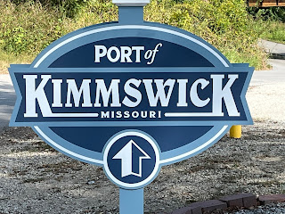
After passing St. Louis, we tied up Hoppie’s. Being nothing more than a few beat up old docks on the side of the river, it is none-the-less a popular stop for Loopers. They offer the last fuel stop for the next 200+ miles, old time Americana character, and their proprietor, Debbie, gives an afternoon briefing on what to expect further down the river, and recommends safe places to anchor between there and the next popular stop, Paducah, Ky. We walked into the town of Kimmswick for some good 'ole meatloaf and chicken fried steak and a big piece of pie to take back to the boat. So far, the Mighty Mississippi didn't seem too scary. We hit the sack that night hoping for a good nights sleep, knowing that the next few nights we would be anchoring out along the river.

 Hoppie's "Marina"


Monday, June 12, 2023

Illinois River to the Key West of the Midwest


Grafton, Illinois at the end of the Illinois River

We woke up eager to get an early start on our second day of our Journey south on the Illinois River only to be met by dense fog. We contacted the other loopers in the marina on VHF and we all decided it would be safer to wait until the fog lifted before heading out.  However, just as we were settling into our second cups of coffee/tea, we saw Baker Street Blue (BSB) appear out of the fog heading past our marina. They had spent the night further north and had already contacted the next lock about passage. BSB advised us the visibility was not too bad on the river and, not wanting to miss out on a lock opening, the rest of us at the marina quickly scrambled to get underway and follow BSB to the Dresden lock. The fog soon lifted, the sun came out, and our travels that day were pretty easy. 

We made it through both the Dreseden and Marseilles lock without any wait and shortly after noon we were tied up in Heritage Harbor near Ottawa, Illinois. This was a very well run facility with a nice pool and restaurant. While Cam and I helped each other re-install our radar domes that we had removed to get under the bridges in Chicago, Karen and Heather enjoyed lounging by the pool. That afternoon, the harbor master, Jeremy, held his daily briefing for all the Loopers. With notebooks and iPads in hand, we took copious notes about river conditions, anchorages and marinas we would be seeing along the rest of the Illinois River. These types of briefings are invaluable in planning for a safe voyage.
Southbound on the Illinois River
Heritage Harbor Marina, Ottawa, Il

We would have loved to stay on at Heritage for a few days but we needed to keep moving. At 6:45 the next morning, we left with our buddy boat Sea Clef and 4 other boats. Our first objective was Starved Rock Lock. We had been advised by  the lock they would have to clear through a few commercial tows before we could lock through so we slowed down to 6 mph from our usual cruising speed of 9mph. Even with slowing down, when we arrived at the lock we were advised we would still have to wait. Our options at that point were to either drift in place or tie up to a "cell" (sometimes referred to as dolphins)  near the lock. This would be a new experience for us. Cells are large round structures built into waterways, usually near dams, bridges, or locks. They are sometimes built to be used as a mooring site for boats. Other times they are constructed to prevent ships from accidentally damaging the structure they are protecting.  In this case, the cell we were advised to tie up to was a circular structure, approximately 15 feet in diameter with a corrugated metal skin filled with concrete. There was a single eye in the middle to tie onto.  Over the previous 6 months we had tied up to a variety of structures….. but never a round one. Fortunately, the current was not strong. After Karen hung a bunch of fenders near the middle of our hull, I was able to float us slowly up to this unforgiving metal structure and Karen was able to scamper off the boat and take one of our lines to the center eye.  I was then able to pass her a second line. Once we were settled, Cam guided Sea Clef up to our side and rafted up with us.  Not having been an avid boater for long, new experiences like this cause Karen a fair amount of anxiety. But she pulled it off like a pro and we could give ourselves a well-earned high five for a successfully tying our straight sided hull to an unforgiving round structure without so much as a scratch!

Two of our "Buddy Boats" tied up to a cell

Within less than an hour after tying up, we got word from the lockmaster that we could proceed into the lock. We had a lot of company in the lock and we were rafted 4 deep. But it was an easy drop and, after exiting the lock, we proceeded down river to our destination for the night, the Henry Lock Wall.

Starved Rock Lock

Barge (Tow) traffic on the Illinois River
Built in 1870 at a cost of $400,000, the Henry Lock and Dam was the first such structure on the Illinois River. The river in that area was shallow enough that for much of the year the river could be crossed by horse and buggy. This made navigation through this area by boat or barge nearly impossible.  Once completed the river was deep enough for navigation but a nearby bridge became necessary to allow the horse and buggy traffic to continue to cross.  In the 1930’s the original bridge was struck by a barge and damaged beyond repair. (I guess they should have installed some protective dolphins!) It has since been replaced twice.  Much smaller than the more modern locks, the old Henry lock was last used in 1927.  The old stone walls are now a popular spot for Loopers to tie up for a night. There is a small marina next to it and the marina operators also care for and manage the old wall. To call it rustic would be generous. But it was a unique place to spend the night. As the walls were rough, irregular and tall, it was not easy to get on and off the boat. Karen never did make it off the boat there.


Old Henry Lock Wall

Our next night was in Peoria Illinois at the Illinois Valley Yacht Club. We got there just in time to purchase the last few tickets to their annual Lobster Boil. Unfortunately, being the last folks to get tickets, we were the last to be served and we were still eating way past “Looper Midnight.” Peoria is the home of Caterpillar Tractors. We did not go, but we heard they have a great factory tour.

Illinois Valley Yacht Club, Peoria, Illinois

With a somewhat ominous weather report we set out the next morning with a group of Loopers for what would be our first night on anchor on the rivers. We dropped the hook behind Quiver Island near Havana, Illinois. The Anchor set well on the first try. Anchorages on the rivers are known for having a lot of debris on the bottoms that can snag anchors so we set the anchor with a “trip line” that would enable us to pull the anchor out backwards if needed. Although there are a variety of floats that can be used to locate the trip line, I figured an old plastic jug would work just as well and help me pass for a “good ole boy.” We could see barge traffic passing by on the river but we were set well back off the main river and the setting was quite peaceful.  Sea Clef hosted “docktails” on their boat and later that night we had rain and an electrical storm show but, fortunately, very little wind.


Anchoring behind Quiver Island

My Hi-Tech float for our anchor trip line
Beautiful sunset was followed by fantastic electrical storm
Weighing anchor the next morning, Karen got a taste of how much of a pain it is to have to worry about the trip line but we got it in ok and had beautiful sunny skies for our 33 mile run to our next unusual spot for a night, tied up to a working barge of Logsdon Tug Service.  The sea (river) wall here at Beardstown, was a good 30 feet tall and we had to climb a tall wobbly staircase to get up on shore. What doesn’t kill ya only makes ya stronger- right? The town was "kinda" cute, in a small town America kind of way and we had lunch at a diner with Cam and Heather and later, docktails on the barge.  It was pretty darn hot that day and there was no electricity on the barge. We ran our generator that evening to run our AC and top off our batteries. One of the great things about our boat is we have enough battery power to run one of our ACs overnight. I never met another Looper who could do that with their boat. We ran our AC that night in our stateroom and slept soundly in air conditioned bliss and still had over 70% battery power left in the morning. Thank you Greenline Yachts!

Beardstown Illinois

Tied up for the night to barge at Logsdon Tug Service

We spent the next night on the docks of Mel’s Illinois Riverdock Restaurant and then continued on to Grafton, Illinois where the Illinois River ends and joins into the Mississippi! Grafton was the largest city we had seen since leaving Chicago 1 week before….wow- that was an interesting week. Grafton Harbor Marina was quite large and impressive. It was our first experience with covered docks. The Mississippi and Illinois rivers can have huge floods, with water levels rising 40ft or more. The whole marina was floating.  Not just the docks…. even the restaurant, offices and pool were floating and the pilings that supported them were huge- over 40ft hi and 2ft in diameter. We spent 4 days in Grafton relaxing, swimming and hanging with other Loopers. We even took a chairlift up a hill to have lunch at a winery.  There was an incredible view up there of the Mississippi and we got our first glimpse of the St. Louis arch in the distance, a site we were looking forward to seeing from the water!


Mel's Riverdock Restaurant

Grafton, IL - Key West of the Mid West


Welcome to Kentucky

This Riverboat Still Cruises The Mississippi and Ohio Rivers We left Hoppie's on a chilly 42 degree morning to continue on down the Miss...